Residents in Surrey and Hampshire are being warned to prepare for scattered thunderstorms on Monday, May 12, with the potential for flooding, power cuts, and travel disruption.
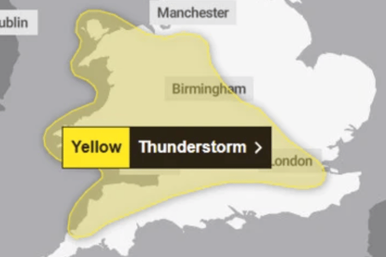
The Met Office has issued a yellow weather warning, highlighting that heavy showers and thunderstorms are expected to develop from Monday afternoon, bringing intense rainfall, lightning, hail and gusty winds.
Up to 30mm of rain could fall in under an hour, with some isolated areas possibly seeing as much as 50mm within two hours. The storms are expected to ease during the evening.
The Met Office warned spray and sudden flooding could make driving hazardous and may lead to road closures.


Lightning strikes and flooding could possibly disrupt bus and train services, with possible delays or cancellations.
There is also a chance that power cuts may affect homes and businesses, while there is also a small risk of rapid flooding in some areas.
The Met Office says residents should check if you’re in a flash flood risk area and prepare a flood kit and plan if necessary.
Other tips include securing outdoor items such as bins, trampolines, or garden furniture ahead of gusty winds.
You should stay informed by checking local travel updates and weather alerts, and adjust travel plans if needed. You can also prepare for possible power outages by having torches, batteries, and a charged power bank ready.
If caught outdoors in a thunderstorm, residents should seek shelter in a car or enclosed structure—avoid trees and high ground.
The warning, issued at 10am on Sunday 11 May, covers a wide area including Greater London, the South East, and parts of the East Midlands, with Surrey and Hampshire among the counties most likely to be affected.
The Met Office advises people to stay weather-aware as warnings may be updated. You can find the full forecast and latest updates on the Met Office website.
Comments
This article has no comments yet. Be the first to leave a comment.