
A lovely simple family there-and-back walk with a river, wildlife and farmland that gives an unusual perspective on the downs and more familiar countryside, with a choice of watching deer, having tea and cake, sets of from Rival Moor Road.
If you’re motoring, park at Penns Place and walk back towards Durford Road. Pass through the Petersfield to Midhurst railway embankment cutting and turn left down a lane.
On your left are a handful of huge concrete domes. As a youngster playing there in the 1960s they were nuclear bunkers, forts and dens, and as we got older, favourite trysting places away from parents’ eyes.
As a teenager I watched a mate wheelie a 250 Yamaha motorcycle up the side of one for a dare. He hit the vent at the top, went over the handlebars and tumbled down!


He lost the bet, but didn’t lose any limbs and thankfully the bike and he were virtually undamaged – although his pride was sorely dented.
But the reality behind these futuristic (well, they were then ) domes is far more mundane. Now a secure builders’ store and yard, they were home to hundreds of battery chickens.
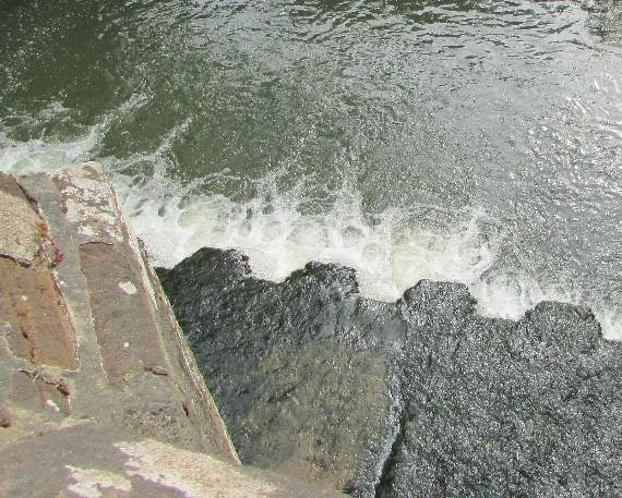
At the end of the lane, go through a kissing gate and follow the path down to a wooden bridge over the River Rother. You are now south of the A272 Rogate road in the valley between the South Downs and the hills north of the A272. It can take a while to place familiar landmarks!
Head up a bank ahead to a stile, climb it, and follow the edge of the field to another stile. Here you can either continue around the field, with the lazily-flowing Rother on your right, or cut the corner across the field to a lone tree.
Although there are a few about, an ageing single tree in a field is not a common sight – and why leave one in the middle of crops to get in the way of tractors and combine harvesters?
The reason, as put forward by a farmer in the White Horse pub in Rogate, is they provided shade for farm labourers. In the days of dawn-to-dusk labour, a shady spot, or one out of the rain, to have breakfast, lunch or supper was welcome.
And before tractors it also gave shade to plough horses, or a hay cart pulling oxen.
To the right of the tree is a pond and the half-hidden Durford Abbey Farm. About a fortnight ago an antlered red deer let me edge to within 15 metres here, before bounding away into trees.
Follow the path between an old metal barn and converted traditional flint barns, go through a hedge and over a field.
On the other side a very narrow claustrophobic path runs between two houses and their hedged gardens, and takes you out on to Durford Lane – and three choices.
You can retrace your steps to your car, or you can turn left past Maryland Cottage towards the A272.
Virtually opposite the cottage is a narrow lane, or layby, that runs parallel to the A272.
Follow it to the end, and on the other side of the A272 is the entrance to Durlieghmarsh Farm – and the farm’s Tea Barn cafe, with refreshing brews and lovely cakes.
Or the third choice, my favourite, is to turn right and head towards West Harting, crossing the Rother on a medieval stone bridge, and continue for about a mile to Sky Park Farm.
The farm breeds deer and just now herds of does and their calves graze the huge fenced paddocks beside the road.
Majestic antlered stags, their job done, rest in neighbouring fields.
For this walk, return the way you came – I sometimes go on into Harting, but that’s a walk of a different name.
Comments
This article has no comments yet. Be the first to leave a comment.